

1) Context & Snapshot
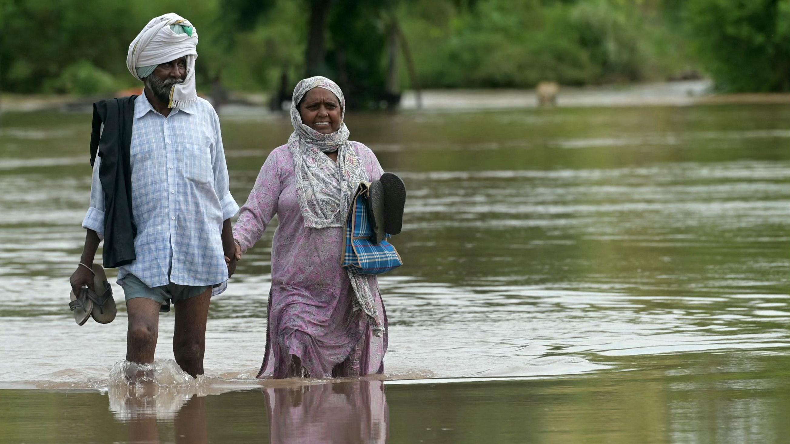
- Why in news: Punjab is facing one of its worst floods in recent years; the state has declared all 23 districts flood-hit.
- Human and farm impact (latest snapshot given):
- 1,902 villages inundated
- Over 3.8 lakh people affected
- More than 11.7 lakh hectares of farmland damaged
- At least 43 deaths reported
- District focus: Gurdaspur is the worst-hit—329 villages submerged, about 1.45 lakh people impacted, and nearly 40,000 hectares of farmland inundated.
- Why it matters: Punjab is the “Food Bowl of India.” Flood shocks here hit national food security, rural incomes, and supply chains.
2) Rivers & Geography (how Punjab’s setting shapes flood risk)
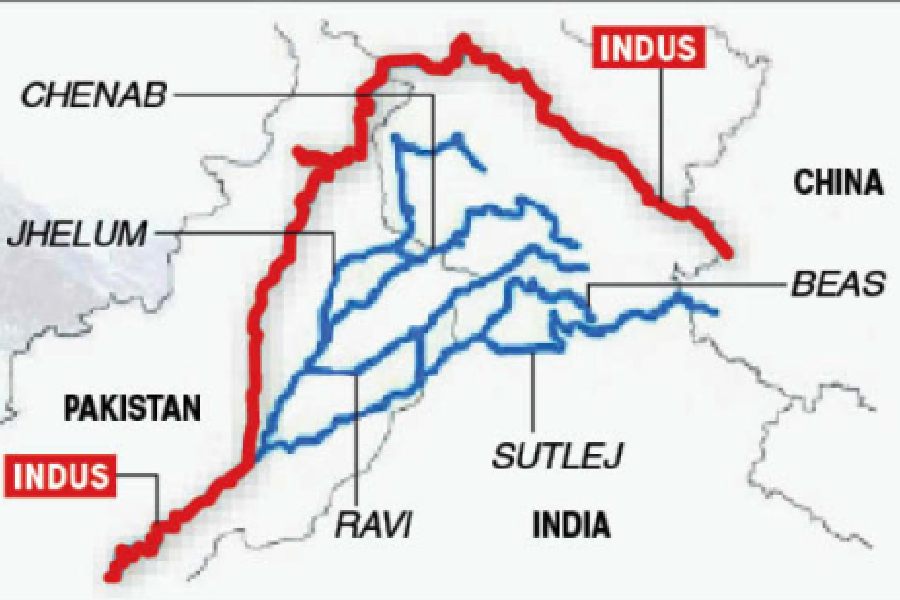
- River system: Punjab means “Land of Five Rivers.” After Partition, Sutlej, Beas, and Ravi remain in Indian Punjab (all part of the Indus system under the Indus Waters Treaty).
- Major rivers:
- Sutlej: Longest in Punjab; Bhakra Dam near Nangal; meets Beas at Harike and later joins the Indus in Pakistan.
- Beas: Pong (Maharana Pratap Sagar) Dam in Himachal Pradesh; flows into Punjab and meets Sutlej at Harike.
- Ravi: Flows along the Indo-Pakistan border; Ranjit Sagar (Thein) Dam near Pathankot.
- Seasonal rivers and hill streams: Ghaggar and numerous choes (seasonal torrents from the Shivaliks) add sharp monsoon flows.
- Fertile plains: Rivers deposit rich alluvium—key to high wheat and rice output—but flat terrain and silted channels make water spread widely during high rainfall.
3) Why Floods Recur (joined-up diagnosis: nature, dams, governance, climate)
A) Natural–hydrologic drivers
- Intense monsoon bursts overwhelm embankments (dhussi bundhs).
- Siltation and encroachment shrink river capacity; floodplains used for farms or settlements reduce room for rivers to spread safely.
- Seasonal torrents from hills deliver sudden flows into low-lying plains.
B) Dams and operations
- Key reservoirs: Bhakra (Sutlej), Pong (Beas), and Ranjit Sagar (Ravi) are managed by the Bhakra Beas Management Board.
- Tight storage in peak monsoon: High water levels in July–August leave limited buffer for extreme rainfall.
- Operational shocks: Sudden releases or infrastructure failures can magnify flooding. Example cited: Madhopur barrage gate collapse (2025) that worsened floods in Pathankot and Gurdaspur.
C) Governance gaps
- Centre–state friction: Punjab alleges flood control gets lower priority than irrigation or power. Leadership changes at the board have reduced state say.
- State-level weaknesses: Poor embankment upkeep, illegal sand mining, slow warnings and evacuations, and weak inter-department coordination.
D) Climate stress
- Erratic, high-intensity rain events are rising. Existing dams and drains were not designed for today’s short-burst extremes.
- Warming and heat-drought-flood swings make water management harder across the year.
4) Impact Assessment (what gets hit and why it persists)
- Agriculture: Prolonged waterlogging damages paddy, fodder, and horticulture; silt and debris raise post-flood input costs (seed, repair, pumps).
- Livelihoods and health: Loss of livestock, unsafe water, vector-borne diseases, and disruption of mandi operations.
- Infrastructure: Flooded roads, culverts, and breached bunds sever market access and slow relief.
- Compounding risks:
- Sand mining and encroachments lower riverbed stability and destroy natural buffers.
- Channelised highways and rail embankments act like dams during heavy rain, trapping water.
- Patchy early-warning reach and limited shelters stretch response capacity.
5) What Should Be Done Now (actionable, exam-friendly reforms)
A) Make flood management a core objective
- Give the Bhakra Beas Management Board a formal flood-control mandate alongside irrigation and power. Ensure Punjab’s representation in operating decisions during monsoon.
B) Operate reservoirs with real-time intelligence
- Use dynamic rule curves based on weather forecasts and inflow models to create buffer ahead of extreme spells. Standardise pre-release protocols, warning lead times, and downstream coordination.
C) Strengthen grey and green defences
- Repair and raise critical embankments; design fuse-plugs and spillways for safe overflow.
- Reconnect floodplains, protect wetlands, and revive natural drainage. Ban illegal sand mining; enforce no-build zones in high-risk belts.
D) Basin-wide planning and drills
- A Ravi–Beas–Sutlej basin plan across Punjab, Himachal Pradesh, and Jammu & Kashmir for reservoir operations, silt management, and emergency routing.
- Community-level early-warning (sirens, IVRS, SMS in local language), ward-wise flood shelters, evacuation maps, and annual mock drills.
E) Climate-smart agriculture and recovery
- Promote short-duration varieties, staggered sowing, drainage channels on fields, and flood-resilient cropping in low-lying panchayats.
- Fast, transparent relief and insurance; credit support for pumps, seed, livestock restocking, and soil health restoration.
F) National framework for Integrated Flood Management
- A national law or protocol that sets forecast-to-release standards, data sharing, performance audits, and funding incentives for states that deliver risk-based zoning and enforcement.
6) Exam Toolkit (data bites + mains questions with brief hints)
Quick data to remember
- 23 districts declared flood-hit; 1,902 villages inundated; over 3.8 lakh people affected; at least 43 deaths.
- Farm loss: More than 11.7 lakh hectares damaged.
- District focus: Gurdaspur—329 villages submerged; about 1.45 lakh people impacted; ~40,000 hectares inundated.
- Key structures: Bhakra, Pong, Ranjit Sagar; failure at Madhopur barrage gate (2025) worsened downstream flooding.
Mains Q1 (150/250 words):
“Explain the hydrologic, infrastructural, and governance factors behind recurrent floods in Punjab. Suggest a basin-wide strategy to reduce losses.”
Hints: Rivers and choes, siltation and encroachments; reservoir operations and limited storage buffers; illegal sand mining; early-warning and evacuation gaps. Recommend dynamic rule curves, joint control rooms, floodplain restoration, embankment upgrades, and drills.
Mains Q2 (250 words):
“Discuss how climate change is altering flood risk in Punjab’s river basins. What reforms in dam operation, land use, and agriculture can build resilience?”
Hints: Short, intense rain spells; design limits of old dams; urban and rural waterlogging. Propose forecast-based releases, strict no-build flood zones, wetland revival, climate-smart cropping, and fast relief–insurance systems.
One-line wrap: To protect lives, farms, and the food bowl, Punjab must move from reaction to prevention—manage reservoirs with real-time intelligence, restore floodplains, and empower local bodies to act before the water rises.
Share This Story, Choose Your Platform!
Start Yours at Ajmal IAS – with Mentorship StrategyDisciplineClarityResults that Drives Success
Your dream deserves this moment — begin it here.