

Syllabus: GS-III & V: Environmental Impact Assessment
Why in the News?
An expert committee and environment authorities in September 2025 cleared the Oju Hydroelectric Project, a large dam-and-underground-powerhouse plan on the Subansiri River in Arunachal Pradesh’s Taksing. The clearance revived national attention because the project is large (over 2 GW), sited near the India–China border, and lies within the ecologically and geologically sensitive Subansiri basin — a river system that has already hosted contentious projects such as the Lower Subansiri HEP.
At a Glance — Key Facts
- Developer / SPV: Oju Subansiri Hydro Power Corporation Pvt. Ltd. (promoted by Navayuga/related consortium).
- Installed capacity: ~2,220 MW (project publicly reported as 2,200+ MW after optimisation).
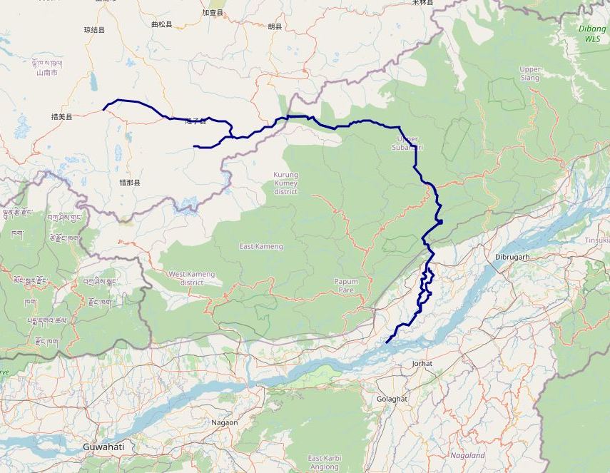
- Location: Upper Subansiri district, Arunachal Pradesh — near Taksing/Redi in the upper Subansiri valley, close to the Indo-China Line of Actual Control.
- Type & key features: Run-of-the-river scheme with daily peaking capability; a ~100 m concrete gravity dam, ~14.12 km headrace tunnel and an underground powerhouse complex are envisaged. Gross storage cited in reports is ~15.66 million cubic metres (MCM).
- Estimated cost & timeline: Project cost reported at about ₹24,942.01 crore and an estimated construction period of around five years (subject to statutory clearances, land/forest permissions and field conditions).
- This will be India’s third largest hydel project to get a green nod after the 3,087 MW Etalin project and the 2,880 MW Dibang project, all of which are being built in Arunachal Pradesh.
What is the Oju Hydel Project?
- The Oju HEP is a large-scale hydroelectric development proposed on the Subansiri River in its upper reaches.
- The design uses a medium-height concrete gravity dam to divert river flows into a long headrace tunnel that feeds an underground powerhouse.
- Because it is designed for diurnal peaking, the project will store water for short durations (gross storage ~15.66 MCM) to supply higher power during demand peaks while being marketed as a run-of-the-river scheme rather than a full reservoir project.
- The run-of-the-river scheme is intended to add significant renewable capacity to India’s northeastern grid and support national energy targets.
EAC’s Safety Directions
While granting environmental clearance, the Expert Appraisal Committee (EAC) asked the company to factor in Glacial Lake Outburst Floods (GLOF) and flash flood scenarios, set up real-time monitoring and early warning systems (EWS) with SDMA and local bodies, and conduct community awareness and mock drills for disaster preparedness.
Significance
- Energy security & renewable capacity: At ~2.2 GW, Oju would be among India’s largest hydropower projects and materially strengthen the North-East grid and national renewable generation mix.
- The dam is expected to produce 8,402 million units of electricity annually.
- Daily peaking capability: The project’s peaking design helps manage diurnal load variations and supports grid stability — a valuable attribute with increasing variable renewable (solar/wind) inputs.
- Regional development & employment: Construction and associated infrastructure (roads, transmission, local supply chains) will create local jobs and upstream economic activity in a remote region.
- Strategic location: Siting close to the international boundary increases the project’s strategic sensitivity; central/state authorities consider both development and security angles.
Subansiri River — Brief Profile
- Origin & course: Rises in the mountains of Tibet, in Lhuntse County (Shannan Prefecture).
- Known as Chayul Chu in Tibet.
- The principal source stream is Sikung Chu, part of the “Chu” family of streams.
- Basin & hydrology: Total length: 442 km.
- Drainage basin: 32,640 sq. km.
- Length distribution: ~60 km in Tibet, 192 km in Arunachal Pradesh (erstwhile NEFA), 190 km in Assam.
- Course: Enters India near Taksing in Arunachal Pradesh.
- Flows east and southeast through the Miri Hills.
- Descends into the Assam Valley at Dulangmukh (Dhemaji district).
- Joins the Brahmaputra River at Jamurighat in Lakhimpur district.
- Tributaries: Major tributaries include Tsari Chu, Rangandi, Dikrong, and Kamala.
- Several Tibetan tributaries named after their origins (Loro Chu, Nye Chu, Char Chu, Chayul Chu).
- Significance: Largest tributary of the Brahmaputra River, contributing ~7.92% of its total flow.
- Lends its name to Upper Subansiri and Lower Subansiri districts of Arunachal Pradesh.
Other Hydel Projects on the Subansiri
- Lower Subansiri HEP (NHPC) — ~2,000 MW: Long-running, highly contested project at the Arunachal–Assam border; its construction history includes stoppages, protests and technical incidents, illustrating the basin’s complexity.
- As per the Environmental Impact Assessment (EIA) report, several other major hydroelectric projects have been proposed/planned on the Subansiri basin:
- Niare Hydropower Project
- Naba Hydropower Project
- Nalo Hydropower Project
- Dengser Hydropower Project
- Upper Subansiri Hydropower Project
- Apart from Etalin HEP and the Dibang HEP, the government is building the 2,000 MW Subansiri Lower Project, expected to be commissioned by May 2026.
Smaller projects include the Heo Hydro Electric Project (240 MW) and Tato-I Hydro Electric Project (186 MW), both under NEEPCO (a subsidiary of NTPC Ltd.). - A proposed 11,000 MW Siang Upper Multipurpose Project (SUMP) aims to counter China’s 60,000 MW Yarlung Tsangpo project near Gelling, Arunachal Pradesh.
- However, the Siang project has been stalled for over a decade due to strong local opposition and is yet to secure environmental clearance.
- China is building a 60,000 MW mega hydropower project on the Yarlung Tsangpo (known as the Brahmaputra in India) near Gelling in Arunachal Pradesh.
- This project, one of the world’s largest, has raised concerns in India over water security, downstream flow impacts, and ecological risks,
Environmental and Social Concerns
- Cumulative impact: The Subansiri basin already hosts multiple large projects; cumulative impacts on hydrology, sediment and ecology remain a prime worry.
- Seismicity & geological hazards: The Eastern Himalaya is seismically active. Dams, tunnels and caverns in such terrain raise concerns about stability, landslides, glacial lake flood and tunnel collapse risks.
- The Subansiri basin falls in seismic zone V, the most vulnerable category.
- Biodiversity & forest diversion: Large projects require forest diversion; the upper Subansiri hosts montane forests and rich biodiversity.
- For instance, the project will require diversion of 750 hectares of forest land.
- Downstream erosion & flood risk: Changes in sediment transport can increase erosion in Assam’s floodplains, threaten agriculture, and alter flood dynamics.
- Livelihood impacts: Displacement, disruption of fishing, and threats to irrigation are serious risks for downstream communities.
- Around 43 hectares will be submerged and a total of nine families will be displaced.
- Obsolete CIA/CCS Study: Assam-based environmentalist Bimal Gogoi highlighted that the Cumulative Impact Assessment (CIA) and Carrying Capacity Study (CCS) for the Subansiri basin were last completed in 2014.
Concerns for Assam
- Sudden releases: Peaking operations or structural failures could trigger downstream surges affecting flood-prone Assam.
- Erosion & livelihoods: Agricultural land loss, fishing disruption, and settlement erosion in Lakhimpur and Dhemaji districts remain critical concerns.
- Studies by the South Asia Network on Dams, Rivers and People (SANDRP) have in the past highlighted repeated monsoon damages at hydropower projects in the region, including the Subansiri Lower project downstream, calling them “ticking water bombs” for Assam.
Government Stand
Authorities frame Oju as a crucial renewable energy and strategic project. Expert committees have recommended clearance, subject to compliance with environmental safeguards, cumulative impact studies, and downstream safety protocols. The government stated that after detailed deliberations on hydrology and ecological flow data, it accepted submissions made by the project proponent in this regard.
Way Forward
- Comprehensive cumulative impact assessments with independent peer review.
- Strong seismic & geotechnical safeguards in design.
- Downstream early-warning systems and safe peaking operation schedules.
- Sediment management & assured environmental flows to sustain ecology.
- Local consultations & benefit-sharing mechanisms for affected communities.
- Phased implementation with strict compliance monitoring.
Conclusion
The Oju Hydel Project is strategically and economically significant, promising substantial clean energy and regional development. At the same time, ramping up hydropower in this strategically sensitive border state also carries a geopolitical dimension, as it helps assert India’s presence along the frontier with China while boosting infrastructure and local development. Responsible governance, rigorous science, and transparent consultation will decide whether Oju becomes a model for sustainable hydropower or a cautionary tale.
Mains-Style Question
“The Oju Hydroelectric Project (Upper Subansiri) promises large renewable energy gains but also raises cumulative environmental and safety concerns in the Subansiri basin.” Critically analyse.(250 words)
Share This Story, Choose Your Platform!
Start Yours at Ajmal IAS – with Mentorship StrategyDisciplineClarityResults that Drives Success
Your dream deserves this moment — begin it here.