Syllabus: GS-III & V: Biodiversity, Conservation
Why in the news?
A satellite imagery-based study has revealed that green cover is rapidly declining even inside protected areas of Assam, with the Panidihing Bird Sanctuary showing alarming levels of grassland loss, forest degradation, and expansion of cropland over the last two decades.
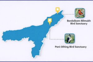
About Panidehing bird sanctuary
|
Key findings of the study
- The study, conducted over 20 years (2001–2021) using satellite data, highlights a systemic failure in protecting legally designated protected areas.
- Panidihing Bird Sanctuary, spread over about 34 square kilometres, has undergone major land use and land cover change due to human activity.
Major land cover changes observed:
- Cropland expansion:
- Covered 25.7 percent of the sanctuary area in 2001.
- Increased to 42.5 percent by 2021, marking a 65 percent rise.
- Grassland decline:
- Grasslands reduced from nearly half of the sanctuary area in 2001 to around one-third in 2021.
- A loss of 11.2 square kilometres of grassland was recorded.
- About 15.1 square kilometres of grassland was converted into cropland.
- Forest loss:
- Overall forest cover declined by about 5.77 percent between 2001 and 2021.
- Even core forest areas, considered least disturbed, recorded a loss of 4.56 percent, indicating deep ecological stress.
- Built-up areas also increased, pointing to gradual human settlement and infrastructure pressure.
Why this is serious
- Grasslands are critical habitats for birds and wetland-dependent species. Their rapid disappearance directly threatens biodiversity.
- Forest fragmentation reduces habitat connectivity, affecting movement, breeding, and survival of wildlife.
- The study warns that faunal populations in the sanctuary may be adversely affected, as both grassland loss and forest fragmentation intensify.
- Under the Wildlife Protection Act (WPA), 1972, once an area is declared a sanctuary, human activities like hunting, grazing, or farming are strictly regulated or prohibited.
- The findings at Panidihing suggest a gap between law and enforcement.
- Rapid decline in green cover is further complicated by the National Forest Policy, 1988, which aims for 33% forest cover across India.
Ground realities
- Fieldwork conducted in December 2022 and January 2023 revealed:
- Limited patrolling and weak protection mechanisms.
- Spread of smallholder agriculture, especially mustard and potato cultivation, inside the sanctuary.
- Researchers observed that while some degraded patches appear to have reduced, many natural patches may have been completely eliminated, masking the real extent of ecological damage.
Larger implications for Assam
- The findings challenge the assumption that legal protection alone ensures conservation.
- Encroachment, agriculture, and settlement pressure are increasingly entering protected areas, not just buffer zones.
- This raises serious concerns for other wetlands, bird sanctuaries, and forest reserves across Assam.
Way forward
- Strengthening patrolling and enforcement within sanctuaries.
- Clear demarcation of boundaries using geospatial tools.
- Community-based conservation, involving local people as stakeholders.
- Integration of satellite monitoring with on-ground action for early detection of encroachment.
- Alignment with national frameworks such as the Wildlife Protection Act, 1972 and National Biodiversity Action Plan.
Exam Hook – Key Takeaways
- Protected status does not guarantee protection without enforcement.
- Grassland ecosystems are as vulnerable as forests, but often receive less attention.
- Remote sensing is a crucial tool for long-term environmental governance.
Mains Practice Question
“Protected areas in India are increasingly facing internal degradation due to land use change.” Discuss with reference to recent evidence from Assam.
Share This Story, Choose Your Platform!
Start Yours at Ajmal IAS – with Mentorship StrategyDisciplineClarityResults that Drives Success
Your dream deserves this moment — begin it here.